


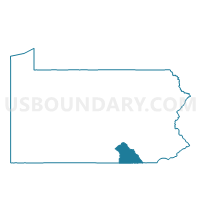
RAILROAD Voting District, York County, Pennsylvania
About
Outline

Summary
| Unique Area Identifier | 664741 |
| Name | RAILROAD Voting District |
| County | York County |
| State | Pennsylvania |
| Area (square miles) | 0.64 |
| Land Area (square miles) | 0.64 |
| Water Area (square miles) | 0.00 |
| % of Land Area | 100.00 |
| % of Water Area | 0.00 |
| Latitude of the Internal Point | 39.75961020 |
| Longtitude of the Internal Point | -76.69607330 |
Maps


Graphs
Select a template below for downloading or customizing gragh for RAILROAD Voting District, York County, Pennsylvania


Neighbors
Neighoring Voting District (by Name) Neighboring Voting District on the Map
- NEW FREEDOM Voting District, York County, PA
- SHREWSBURY TWP DIST 01, York County, PA
- SHREWSBURY TWP DIST 02, York County, PA
Top 10 Neighboring County Subdivision (by Population) Neighboring County Subdivision on the Map
- Shrewsbury township, York County, PA (6,447)
- New Freedom borough, York County, PA (4,464)
- Railroad borough, York County, PA (278)